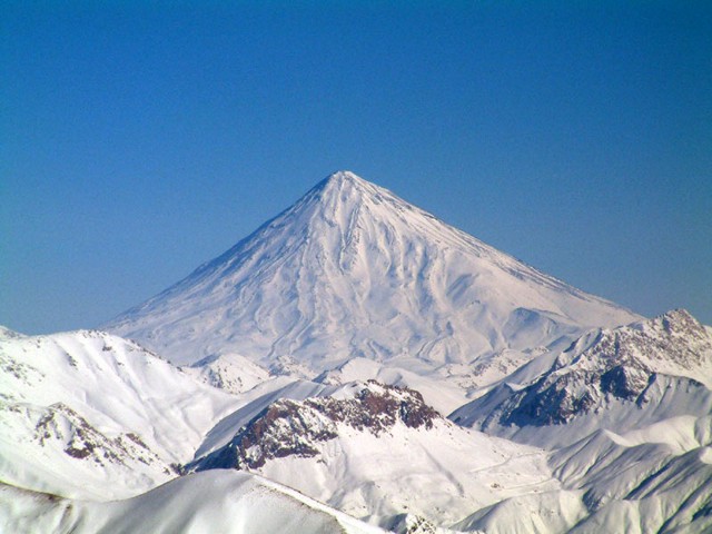
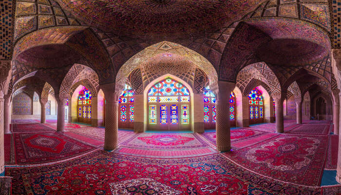
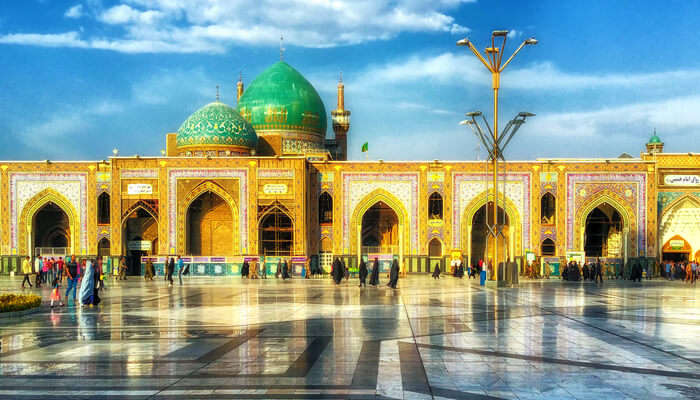
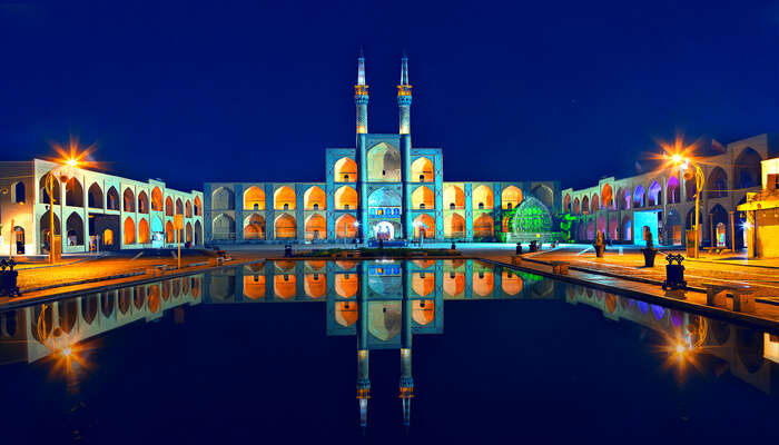
Wednesday, May 15, 2024

Final hazards report’


Iran

Main Natural Hazard: Drought


The drought is an extended period of dry weather when in not enough rain for the normal water cycle end in consequence people can confront high changes of temperature for people and animals, damage to crops, shortage of drinking water. However, the main changes don't stop here. 


I am addressing this how priority because the effects and consequences can be political issues trying to resolve some problems caused to shortages of water, violence, corruption and migration to other places or countries. 

Where?
We are exploring the different hazards in Iran around all of this research, but one of the most dangerous hazards that Iran had is the drought issues.

Why Happen 
The water is running out on the middle east cause the high temperatures in consequence with the climate change around the world. In the future the areas could become uninhabitable, water resources like rivers and lakes could worsen; more political violence could erupt. The country is experiencing some of the driest conditions in five decades, according to the country’s meteorological service.

The Middle East’s winters are projected to get drier the more the world warms, and while the summers will be wetter, the heat is expected to offset its water gains, according to scientists’ latest projections published earlier this month by the UN Intergovernmental Panel for Climate Change report. “The problem is, with this whole temperature rise, whatever rainfall will come will evaporate because it is so hot,” Mansour Almazroui, director at the Center of Excellence for Climate Change Research at Saudi Arabia’s King Abdulaziz University. This is really a big climate change issue.

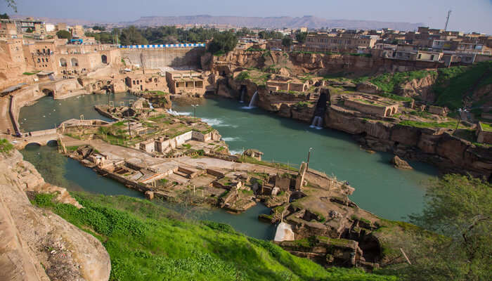
Iranian groundwater and wetlands are irreversibly depleted, water experts say. Because of climate change, Iran can expect hotter temperatures and longer dry spells, as well as a greater risk of destructive floods.

Yet the country continues to spend precious water on agriculture, which does little to expand the economy but keeps people working in rural Iran, where many government supporters live. It is also developing already-thirsty areas that will only demand more water.

Recommendations

Drought observation and monitoring, drought planning and preparedness, prediction and forecasting of drought communication and outreach to the public and affected sectors; and interdisciplinary and applied research on topics of concern to drought-affected sectors.


Drought is a slow-onset hazard that can last for months or years. As a hazard, it has the potential to impact many aspects of life, including two of our most important needs: drinking water and food. Because of the long duration of droughts, the impacts last for years and can ripple through a community over time. Severe droughts are projected for the coming decades and may increase incidences of other events, like wildfires. Drought will affect the viability of communities and the economy across the nation. Working with state officials and tribal leaders, the Federal Emergency Management Agency (FEMA) is an active partner in helping communities plan for drought mitigation. 

FEMA’s work in mitigation planning and advancing mitigation action supports the Presidential Memorandum and Federal Action Plan on Building National Capabilities for Long-Term Drought Resilience. This work supports communities taking action to reduce the impacts of drought hazards through the hazard mitigation planning regulations established in Title 44 of the Code of Federal Regulations (CFR) Part 201. Hazard mitigation planning includes the development of a strategy for risk reduction. FEMA encourages communities to plan for all hazards, including drought, and supports the use of watershed-level planning for hazard mitigation. Hazard mitigation supports drought resilience throughout the planning process, in the risk assessment, and in the mitigation strategy. Planning Process—The mitigation planning process encourages the engagement of a wide range of sectors in plan development. These sectors include, but are not limited to, emergency management, economic development, land use and development, housing, health and social services, infrastructure, and natural and cultural resources. Also, climatologists can help gather drought data and help communities understand the impacts of drought. Because drought can affect many aspects of a community, it is important to bring a wide range of sectors to the table. Each sector can contribute expertise and resources to manage chronic drought, and together they can address the hazard comprehensively.


I could a house in Iran, it cannot be on the regiones to life in Iran's south and east are considering arid, danger and uninhabitable.


Sunday, April 28, 2024

Week 13 Coastal erosion

 Coastal erosion is a normal process of nature. However, the rate of coastal erosion, and the frequency and intensity of coastal flooding events, are now on the rise around the world due to the changing climate.


    The western Makran coast displays evidence of surface uplift since at least the Late Pleistocene, but it remains uncertain whether this displacement is accommodated by creep on the subduction interface, or in a series of large earthquakes.


    During the past 13,000 yr, the climate of the Makran region and the sea level have changed significantly, the Makran coast has experienced an active uplift, and large amounts of sediment have been transported to the Makran continental margin. Therefore, the Makran continental margin is a natural laboratory to study the role of climate change, sea level fluctuations, and tectonic uplift in the evolution of sedimentary systems on continental margins. 

    The coast of Makran is more susceptible to erosion due to the reduced vegetation, and coastal rivers were able to transport river sediments to the continent margin during the brief but intense winter rainfall periods, even under relatively dry climates. On the central coast of Makran, small watershed rivers also can transport fine-grained rocks from the coastal plain. Meanwhile, the wave erosion in the late Holocene was still very intense. The bay beaches along the coast usually crenulated following the dominating wave direction, which further proves the role of waves. A large number of faults along the coast of Makran cause the juxtaposition of units of different erodibility at the same structural level, and the differential erosion of waves brings a large number of sediments to the Makran continental margin and further forms a unique coastal geomorphology. Therefore, in the late Holocene, river sediments, wave eroded materials, eolian dust under arid conditions, and huge amounts of thick sediments deposited on the shelf during the early Holocene were potential sources of material for the continental slope environment. 


Coastal erosion and climate change: A review on coastal-change process and modeling | Ambio (springer.com)

jmse-09-00891 (2).pdf

(PDF) Holocene Sedimentary Record and Coastal Evolution in the Makran Subduction Zone (Iran) (researchgate.net)


Friday, April 5, 2024

Week 10 Extreme Wether


Extreme Weather Iran

    Scientists with the World Weather Attribution group analyzed three years of temperature and precipitation data and found that climate change contributed to extreme temperatures, which in turn made drought at least 25 times more likely in parts of Syria and Iraq, and over 16 times more likely in Iran. 


    The study shows how climate change is playing a role in one of the world’s worst humanitarian disasters, combining with political chaos and conflict to push people into hunger and forcing many to flee their homes.


    The country’s climate is mainly arid and semiarid, except the northern coastal areas and parts of western Iran. The climate is extremely continental with hot and dry summer and very cold winter particularly in inland areas. Apart from the coastal areas, the temperature in Iran is characterized by relatively large annual range, about 22°C to 26°C. The rainy period in most of the country is from November to May followed by dry period between May and October with rare precipitation. 

    The average annual rainfall of the country is about 240 mm with maximum amounts in the Caspian Sea plains, Alborz and Zagros slopes with more than 1,800 and 480 mm, respectively. Iran has climatological diversity with three types of climate: 1) dry and semi-dry climate: large parts of internal lands and southern border of Iran have this climate; 2) Mountainous climate, which itself is subdivided into two categories of cold and moderate mountainous climate; 3) Caspian climate: narrow and small area between Caspian Se and Alborz Mountain Belt with 600-2000 mm annual rain.

    The IPCC estimates an increase in temperature in the Middle East up to 2 °C in the next 15–20 years and over 4 °C by the end of the century. This fact is combined with a decline in precipitation by 20% (IPCC 2007; Elasha 2010). Hence, the Middle East countries are very vulnerable to facing climate change effects. Among the Middle East countries, Iran will experience an increase of 2.6 °C in mean temperatures and a 35% decline in precipitation in the next decades (NCCOI 2014). Hence, the climate change fact of Iran is more severe than the Middle East region.


    Several researchers have reported the heat waves will be increased (30%) by the end of the century for Iran and West Asia (Zhang et al. 2005; Rahimzadeh et al. 2009; IPCC 2012). Therefore, many reports observe a steady decline in annual rainfall (~ 30%) (Nazaripour and Daneshvar 2014). Spatial and temporal trend of precipitation has been widely studied in Iran by several researchers. The literature review revealed that two high mountain ranges of Zagros and Alborz in west and north, respectively, strikingly affect the temporal and spatial patterns of rainfall and temperature (Dinpashoh et al. 2004; Modarres and Sarhadi 2009; Tabari and Talaee 2011; Raziei et al. 2012; Soltani et al. 2012; Somee et al. 2012; Dinpashoh et al. 2014; Darand and Mansouri Daneshvar 2014; Darand et al. 2015; Zarenistanak et al. 2015; Ghalhari et al. 2016; Roushangar et al. 2018).


    For instance, Rainfall trends analysis of Iran using the Mann–Kendall test indicated a decreasing trend in annual and seasonal precipitation at stations mostly occurring in the northwest of Iran (Modarres and Sarhadi 2009). Similar research using the Mann–Kendall test showed a significant negative trend in annual precipitation series at Iran especially in the winter series (Tabari and Talaee 2011). Another research found a relatively regular year-round distribution of precipitation in the north of Iran, but an extreme concentration of precipitation in a few months of the year was detected for the southern country (Raziei et al. 2012). A noticeable decrease in the precipitation series has been indicated in northern Iran, which has temperate weather affected by Alborz Mountains and the Caspian Sea (Somee et al. 2012).

    Regionalization of precipitation regimes in Iran using principal component analysis and hierarchical clustering analysis revealed that the main precipitation regime is in the winter season. In some parts of southern and southeastern of Iran, more than half of the total precipitation occurs in the winter. With moving away from the mentioned regions to the north and the Caspian Sea coast, the contribution of autumn precipitation to total one becomes higher than winter precipitation. The precipitation regime of northwestern parts of Iran is classified in the spring season. The contribution of summer precipitation to total precipitation is noticeable in the southern parts of the Caspian Sea and Southeastern areas (Darand and Mansouri 2014). Spatial and temporal trend analysis of temperature extremes in Iran revealed that about 66% of the country has a significant positive trend in the frequency of hot days and nights, while about 40.9% and 68.5% have a significant decrease in frequency of cold days and nights, respectively.


An overview of climate change in Iran: facts and statistics | Environmental Systems Research | Full Text (springeropen.com)

The Implications of Climate Change in Iran — American Iranian Council (us-iran.org)


Friday, March 15, 2024

Week 8: Mass Wasting Iran

 What is Mass wasting?

    Mass wasting, sometimes known as slope or mass movement, is the large movement of soil, rock, and debris downhill because of the force of gravity. It is a natural phenomenon initiated by gravity but made possible by a combination of several factors. Modern geography has enlarged the definition of mass wasting to include natural erosion and the submerging of the earth's surface. Mass wasting occurs along slopes such as hill or mountain sides and can result in significant alteration of the surrounding terrain. Mass wasting is a form of landslide.

Causes Of Mass Wasting:

Several factors cause mass wasting besides gravitational pull. They include:

  • Volcanic Activities
  • Earthquake Shocks
  • Landslides
  • Mudslide

Types Of Mass Wasting:

Rockslides And Rockfalls

A rockslide occurs when a mass of bedrock in a slanted surface moves rapidly along a fault. The slide results in the shifting of rocks that destabilize the surrounding environment leading to a rock avalanche.

Debris Flows

Debris flows are the common types of mass wasting. This form of mass wasting involves the movement of earth downslope as a single block or as mudflow. The flowing debris moves rocks, trees, houses, and vehicles along the path.

Soil Creep

Soil creep is the mass movement of the earth over a long time. It is caused by the slow movements of rocks and soil in different directions because of gravity. The movement is proportional to the slope. Trees and shrubs remain perpendicular, and it is hard to notice the mass wasting using the naked eye.


Monitoring Mass Wasting

In some areas, it is necessary to establish warning systems so that we know if conditions have changed at a known slide area, or if a rapid failure, such as a debris flow, is actually on its way downslope.

Mitigating the Impacts of Mass Wasting


In situations where we can’t predict, prevent, or delay mass-wasting hazards, some effective measures can be taken to minimize the associated risk.
 
Iran Mass wasting: Iran faces significant challenges related to both agricultural waste and mass wasting. Let’s delve into each of these issues.

Agricultural Waste in Iran:
Global agricultural waste poses a serious threat to food security. Unfortunately, Iran contributes significantly to this problem.

Annual food waste in Iran
: Each year, Iran wastes 35 million tons of food during various harvesting stages, which is 25 times more than the annual agricultural waste produced by developed countries.

Potential impact: The wasted food in Iran could actually feed 15 million people annually.

Value of wasted food:
The value of this wasted food is equivalent to half of the country’s oil revenue.

Resource wastage: By discarding food, Iran also wastes 300 million liters of fuel and 13.7 billion cubic meters of water that were required for its production.

Water consumption: Due to drought conditions and high evaporation rates, Iran allocates 90% of its water consumption to agriculture.

Mitigation strategies: To address this issue, Iran must improve farming practices, enhance supply chain efficiency, and implement better government policies. Legislation, support for farmers, and investment in technology are crucial steps1.

Mass Wasting in Iran


Geographic context: Iran is located in the Alps–Himalaya seismicity belt, making it prone to mass wasting events.

High potential:
The seismic activity in Iran leads to landslides and rock falls in the high mountains of Alborz and Zagros.

Impact: These mass wasting phenomena pose risks to transportation, infrastructure, and human safety.

Awareness and mitigation: Understanding the factors contributing to mass wasting and implementing preventive measures are essential for minimizing its impact.


What Is Mass Wasting? - WorldAtlas

15.3 Preventing, Delaying, Monitoring, and Mitigating Mass Wasting – Physical Geology (opentextbc.ca)

Friday, February 23, 2024

Week 5 Volcanoes Hazard of Iran


Volcanic mountains form due to the eruption of molten material and the accumulation of such material. An explosion occurs when the pressure of gases and molten rocks in the Earth's core becomes excessively high. Outbreaks can occur slowly or explosively, accompanied by molten material flows, toxic gases, ash emissions, and volcanic fire. Iran has five volcanoes: Damavand, Sabalan, Taftan, Bazman, and Sahand. Out of these, Bazman, Taftan, and Damavand are considered active volcanoes.


Bazman

 (stratovolcano 3490 m / 11,450 ft)
Bazman volcano is a stratovolcano in SE Iran, 180 km SSW of the city of Zahedan. The volcano has a well-preserved 500 m wide summit crater with minor fumaroles, which suggest it could be still active. 

Bijar Volcanic Field

 (Pyroclastic cone(s) unknown)

Damavand

 (stratovolcano 5670 m / 18,602 ft)
Conical snow-capped Damavand volcano is the highest volcano in the Middle East. It towers dramatically 70 km to the NE above Iran's capital city of Tehran. Activity at the 5670-m-high stratovolcano has been dominated by lava effusion. Young lava flows erupted from the summit vent blanket the western side of the volcano, and the youngest dated lava flows were erupted about 7000 years ago. Photo by Arad Mojtahedi, 2006 (http://en.wikipedia.org/wiki/Image:Damavand_in_winter.jpg)
Damavand volcano is a majestic stratovolcano located 70 km NE of Tehran and 70 km south of the Caspian Sea. Mt Damavand is the highest peak in the Middle East and the second highest volcano in Asia (after Kunlun volcano in Tibet).
Damavand last erupted about 7,300 years ago... [more]

Dehaj-Meduk

 (Volcanic field unknown)

East Neh

 (Unknown unknown)

Gandom Beryan

 (Unknown 500 m / 1640 ft)

Kuh-e Ayyub Ansar

 (Lava dome 2506 m / 8222 ft)

Qal'eh Hasan Ali

 (maars unknown summit elevation)
Qal'eh Hasan Ali volcano is a group of 14 maars about 5,000-50,000 years old in SE Iran. The maars range from 150 to 1200 m in diameter. The largest of the maars Great Crater, 1.2 km wide and 200-300 m deep. 

Sabalan

 (stratovolcano 4811 m / 15,784 ft)
Sabalan volcano (Kuhha-ye-Sabalan) is a massive andesitic stratovolcano in NW Iran, 80 km west of Caspian Sea and west of the city of Ardabil.
It is the second highest volcano of Iran (after Damavand volcano) and the highest peak in NW Iran. Sabalan volcano has 7 glaciers c.

Sahand

 (stratovolcano 3707 m / 12,162 ft)
Sahand volcano (also known as Kuh-e-Sahand) is a stratovolcano in NW Iran, about 60 km east of Lake Urmia (Azarbayjan-e Gharbi) and 40 km SSE of Tabriz city.
There are no known historic eruptions, but the volcano is possibly still active and has probably erupted within the.

Shahsavaran

 (Volcanic field unknown)

Taftan

 (stratovolcano 3940 m / 12,926 ft)
Taftan volcano is a strongly eroded stratovolcano in SE Iran. The andesitic volcano has 2 summits (Narkuh and Matherkuh). Very active sulfur fumaroles are found at the summit of the higher SE cone.
Reports of activity in 1902 and 1993 are uncertain.

unnamed

 (volcanic field unknown summit elevation)
A large young lava field which probably has been active within the past 10,000 years is located in the far NW corner of Iran, near the border with Azerbaijan, about 40 km east of the Iranian city of Maku.

unnamed

 (volcanic field unknown summit elevation)
An unnamed volcanic field is located between Taftan and Bazman citied in SE Iran. It contains very young-looking basaltic lava flows erupted from perfectly preserved cones, located in an area of eroded Cretaceous limestone peaks. 

Friday, February 9, 2024

Week 3: Earthquakes

 An earthquake is caused by a sudden slip on a fault. The tectonic plates are always slowly moving, but they get stuck at their edges due to friction. When the stress on the edge overcomes the friction, there is an earthquake that releases energy in waves that travel through the earth's crust and cause the shaking that we feel.

Iran is an extremely earthquake-prone country. These natural disasters have caused the country tragic loss of life and hundreds of billions of dollars in infrastructure damage. Over time, the Iranian government has implemented some mitigation efforts to limit damage, however, these efforts have not been sufficient, and regulations remain unenforced due to economic turbulence. 


What actions has Iran taken to mitigate the consequences of earthquakes?

Earthquake mitigation typically comes in three stages: prevention, control, and rehabilitation. Earthquake prevention is geared towards early detection of a seismic event. In 2017, Tehran began developing an Earthquake Early Warning (EEW) system to detect seismic activity within the city. This detection system has since evolved significantly, and studies show that it provides reliable and accurate warnings of earthquakes from 1 second to 20 seconds. While seemingly a short amount of time, this provides crucial moments for individuals to locate shelter as the quake continues. 

Iran has also opted to alter its architecture in response to earthquakes, developing earthquake-resistant homes. Poor architecture and building materials have caused damage to Iranian towns and villages when faced with earthquakes, as they often lack internal resistance and support. After an earthquake in 1962, Iranian architects and scientists gathered to create the “Iranian Code for Seismic-Resistant Buildings Design”, which established codes and regulations for buildings being constructed within Iran. Other private architects within Iran have also opted to create designs to decrease damages caused by earthquakes.


  We can see the most recent activity on the eartquaketrack  Today's Earthquakes in Iran (earthquaketrack.com)

Iran has had: (M1.5 or greater)

  • 0 earthquakes in the past 24 hours
  • 0 earthquakes in the past 7 days
  • 4 earthquakes in the past 30 days
  • 158 earthquakes in the past 365 days

Friday, February 2, 2024

Week 2 Tectonic plates and boundaries in Iran


What Is a Tectonic Plate Boundary?

The surface of the earth is composed of about 20 tectonic plates, enormous sections of Earth’s crust that roughly fit together and meet at places called plate boundaries. Plate boundaries are important because they are often associated with earthquakes and volcanoes.


The Iranian Plate is a small tectonic plate thought to underlie the Persian plateau, covering the modern-day countries of Iran and Afghanistan, and parts of Iraq and Pakistan. It is compressed between the Arabian Plate to the southwest, the Eurasian Plate to the north, and the Indian Plate to the southeast.\


Iran is situated in a geologically complex region where several tectonic plates interact. Let’s explore the details:

Iranian Plate: The Iranian Plate is a small tectonic plate that underlies the Persian plateau. It covers modern-day Iran, Afghanistan, and parts of Iraq and Pakistan.
 The plate is compressed between three major neighboring plates: To the southwest, it meets the Arabian Plate. To the north, it interacts with the Eurasian Plate. To the southeast, it borders the Indian Plate. This compression has contributed to the formation of the Alborz and Zagros Mountains, resulting in the very mountainous terrain of the region1.

tectonic plates and boundaries in Iran - Search Images (bing.com)


Tuesday, January 23, 2024

Iran Geological Panorama


IRAN


With an area of 1,648,195 square kilometers (636,372 sq mi), Iran ranks seventeenth in size among the countries of the world. The topography of Iran consists of rugged, mountainous rims surrounding high interior basins.There are no major rivers in the country. Iran has a variable climate. In the northwest, winters are cold with heavy snowfall and subfreezing temperatures. Spring and fall are relatively mild, while summers are dry and hot. In the south, winters are mild and the summers are very hot, having average daily temperatures in July exceeding 38 °C (100.4 °F).

Mount Taftān, a massive cone reaching 13,261 feet (4,042 metres) in southeastern Iran, emits gas and mud at sporadic intervals. IRAN has the best Islamic architecture and some of the best people. Between the countries in theMiddle east and the world.


Best Places for Visit in Iran:

 TehranTehran_18th Feb

One of the top places to visit in Iran, Tehran is a busy metropolis set against the Alborz mountains. 


Tabriz
a fine historical heritage

Rich in Azeri culture, Tabriz is known for its thriving bazaar and if you are looking for places for shopping in Iran.


Esfahan
iving museum of traditional culture

The old Islamic buildings along with the Persian gardens give this city a beautiful appeal. The picture-postcard bridges are the highlight of this place in Iran.


Shiraz
Shiraz is known for poetry and wine

Shiraz is known for poetry and wine. 


Mashhad
Mashhad is a city worth visiting

 Mashhad is a city worth visiting. Plan your holiday well because, during Muslim holidays, the city is completely booked months.


Yazd
admiring the beauty of the architecture

 Yazd invites everyone to explore the maze of its lanes.


Kashan
An architectural gem

An architectural gem, the archaeological findings say that the city was founded some eight thousand years ago.


Ahvaz
city is rich in ethnic diversity

These bridges which have made the city famous are built over the river Karun.

Disaster Risk

Disaster risk is a product of a combination of hazard, exposure, and vulnerability. Governance in the health system is a multifaceted sphere, with political, economic, and legal dimensions. The probabilistic natural disaster hazard zoning maps are provided through intensity assessment of mulltihazards. This provided a preliminary basis for geo-hazard risk mapping in Iran, including the vulnerability and popullation exposure. The most improtant geo-hazards involved in this study are earthquake, flood, landslide, and landsubsidence


Hazards:

Iran is in a region prone to many natural and manmade hazards. Hazards such as earthquakes, drought, and floods are the most important causes of death and economic damages.


Disasters:

Iran is a disaster-prone country that has experienced more than 250 natural disasters over the past century, including floods, earthquakes, droughts, storms, and others. 1 These disasters have affected more than 60 million people, killing at least 158,350, and causing an estimated damage of more than US$53 billion. 2 In the same period (1922–2021), Tehran and its neighboring provinces (Alborz, Markazi, Qazvin, and Qom) experienced 28 natural disasters, mainly floods and earthquakes, affecting around 11 million people, killing at least 55,769, and causing economic damages of about US$22 billion 


Catastrophes:


The quakes struck in quick succession, with the more powerful one measuring a magnitude of 6.4, the United States Geological Survey reported. Iranian news media said that the epicenters were near four smaller cities north of Tabriz: Ahar, Heris, Mehraban and Varzaqan.


Approximately 895,000 people in Iran have been internally displaced due to disasters since 2010.
Floods that hit Iran in 2019 “triggered more internal displacement than any other event at the regional level during that period,” a new report says. 


A couple sit in their destroyed house in Dahoueieh on the outskirts of Zarand, a town 35 miles northwest of Kerman, Iran on Wednesday Feb. 23, 2005. A powerful earthquake shook central Iran on Tuesday, destroying villages, killing at least several hundred people and injuring more than 1,000, state-run television reported. (AP Photo/Hasan Sarbakhshian)


Bibliography: 

Disaster risk governance in Iran: Document analysis - PMC (nih.gov) 

natural dissater in iran - Search (bing.com)

Iran Earthquakes Leave 300 Dead - The New York Times (nytimes.com)


Final hazards report’

  Iran Main Natural Hazard: Drought The drought is an extended period of dry weather when in not enough rain for the normal water cycle end ...